GEOLOGICAL
Historyof
MATTAWA AREA
Background:
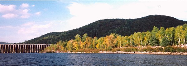
The Town of Mattawa is fortunate to have two rivers meet within the Canadian Heritage River. The Mattawa River which flows from Trout Lake at North Bay through a scenic series of lakes (Talon, Pimisi, Chant Plein, Boom,) rapids and waterfalls until it joins the mighty Ottawa River at Mattawa.
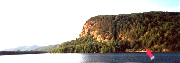
The Ottawa River has its origin in Lake Temiskaming to the north and follows a moderately active faultline through a veritable canyon of cliffs to a more level country on its way some four hundred miles past the city of Ottawa into the St. Lawrence. Moosehead Rock, near Mattawa, on the Quebec side is such a vertical cliff, it is visible from the secondary highway to Thorne.
- Virtual tour/
- Community/
- Geological/
- Heritage River/
- Transportation/
- Natives/
- Anahareo/
- Making Bannock/
- Fur trade/
- Lumbering/
- Lumbering Continued/
- John Argo/
- Deux-Rivieres/
- Cameron/
- Papineau/
- Calvin/
- Kiosk/
- Mattawan/
- Firmin/
- Local Characters/
- Local Character I/
- Military/
- Ecotourism/
- Closing